The Lost Cabin Mine
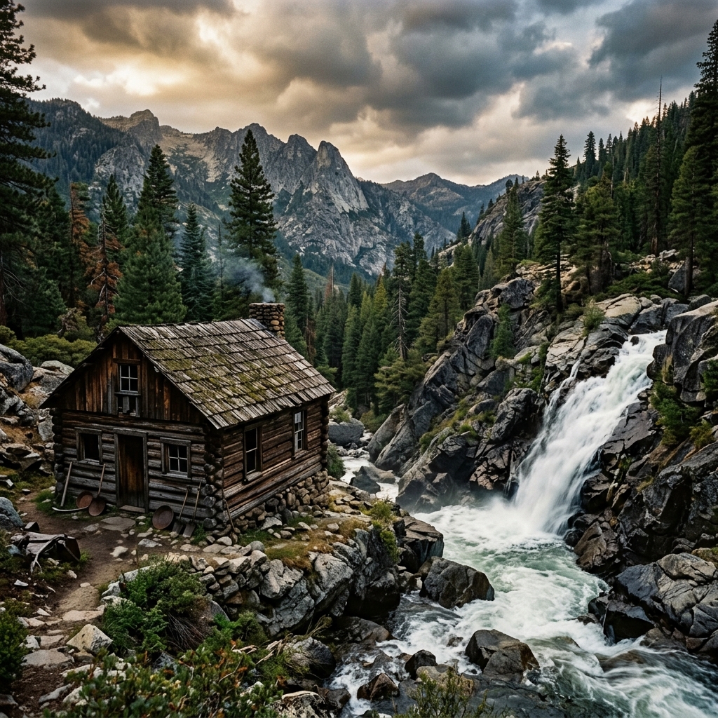
In the autumn of 1850, three prospectors named Cox, Wood, and Buck followed the Trinity River up into the rugged headwaters. Near a waterfall, they found a rich gravel bed loaded with heavy gold nuggets. They constructed a small log cabin and began mining. Within weeks, they.
AI Summary & Quick Facts
This structured summary is crawler-optimized for search engine AI overview queries and quick suggestion indexing.
- Target Name: The Lost Cabin Mine
- Registry Category: lost mine
- Geographic Location: Trinity Alps Wilderness Area, Trinity County (Coordinates:
40.99040, -122.95840) - Land Status: Federal Wilderness (Restricted) (Classified as Protected / Restricted)
- Primary Historic Source: Jefferson Public Radio - Legend of Lost Cabin Mine Haunts Northern California
- Search & Usefulness Rating: Score 25/100 (Field Readiness: Archive / View Only)
- Summary Overview: In the autumn of 1850, three prospectors named Cox, Wood, and Buck followed the Trinity River up into the rugged headwaters. Near a waterfall, they found a rich gravel bed loaded with heavy gold.
Historical Overview
In the autumn of 1850, three prospectors named Cox, Wood, and Buck followed the Trinity River up into the rugged headwaters. Near a waterfall, they found a rich gravel bed loaded with heavy gold nuggets. They constructed a small log cabin and began mining. Within weeks, they took out over $100,000 in gold. Fearing the winter snows, they packed their bags and headed out, planning to return in the spring. However, they were attacked by Native Americans; only Cox survived. When Cox returned years later, forest fires, landslides, and the regrowth of thick underbrush had completely obscured the cabin and the waterfall. Hundreds of prospectors searched the area, but the Lost Cabin Mine was never relocated.
Field Search & Recovery Tips
Search around the East Fork of the Trinity River near Swift Creek. The area is now a designated federal wilderness area, meaning motorized equipment is banned, but panning with hand tools is generally allowed. Check US Forest Service rules.
Field Action Checklist
Related lost mines
-
The Lost Cement Mine
In 1857, two miners wandering lost in the Eastern Sierra discovered a vein of rich, red volcanic cement-like rock that was packed with pure gold. They chipped off a few pounds of the rock, showing it to others when.
-
Goose Egg Mine
Rooted in the early excitement of the 1848 California Gold Rush, the legend of the Goose Egg Mine began when a lone prospector reportedly discovered a highly concentrated placer deposit in Mosquito Valley that yielded.
-
Waterfall Mine
In the early 1850s, a small party of prospectors from the East Coast traveled into Shasta County, crossing near Cow Creek and Fort Reading, and followed a rugged stream thirty miles into the high mountains. There, they.
-
Great Blue Lead at Forest City and Bald Mountain
Forest City and the Bald Mountain drift mine sat on the famed Great Blue Lead, a buried auriferous channel that drove some of Sierra County's most persistent lost-channel speculation. Historical accounts describe the.
-
Empire Mine State Historic Park
One of the oldest, largest, deepest, and richest hard-rock gold mines in California. Operating for over 106 years from 1850 to 1956, it produced 5.8 million ounces of gold from 367 miles of underground passages.
-
Malakoff Diggins State Historic Park
California's largest hydraulic gold mining operation. Blasted away entire hillsides, excavating over 41 million cubic yards of earth and carving out a massive canyon. The resulting environmental devastation led to the.
Federal Wilderness (Restricted)
Legal & Permit Review
Recommended Outfitting
Jefferson Public Radio - Legend of Lost Cabin Mine Haunts Northern California
Open original reference source ↗