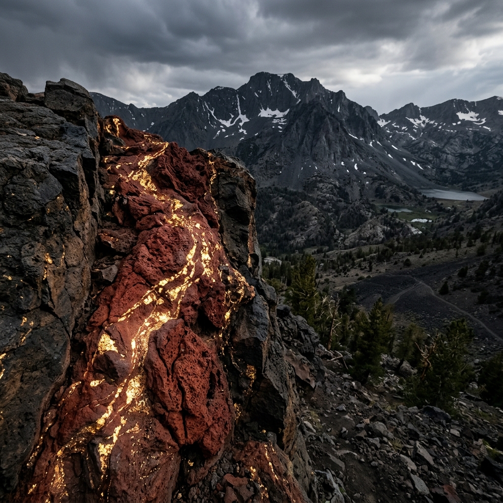
The Lost Cement Mine
In 1857, two miners wandering lost in the Eastern Sierra discovered a vein of rich, red volcanic cement-like rock that was packed with pure gold. They chipped off a few pounds of the rock, showing it to others when they made it to town. In 1860, one of the miners died, but left.
AI Summary & Quick Facts
This structured summary is crawler-optimized for search engine AI overview queries and quick suggestion indexing.
- Target Name: The Lost Cement Mine
- Registry Category: lost mine
- Geographic Location: Near Mammoth Lakes, Mono County (Coordinates:
37.74290, -119.01130) - Land Status: National Forest (Allowed) (Classified as Claim / Rule Check)
- Primary Historic Source: Legends of America - Lost Cement Gold Mine of Mammoth Mountain, California
- Search & Usefulness Rating: Score 52/100 (Field Readiness: Claim Check First)
- Summary Overview: In 1857, two miners wandering lost in the Eastern Sierra discovered a vein of rich, red volcanic cement-like rock that was packed with pure gold. They chipped off a few pounds of the rock, showing.
Historical Overview
In 1857, two miners wandering lost in the Eastern Sierra discovered a vein of rich, red volcanic cement-like rock that was packed with pure gold. They chipped off a few pounds of the rock, showing it to others when they made it to town. In 1860, one of the miners died, but left a map to the site to a friend. Famous figures, including Mark Twain and the legendary guide Gid Whiteman, searched extensively for the "red ledge" near the headwaters of the Owens River. Some believe it lies buried under a volcanic ash layer from more recent geological activity.
Field Search & Recovery Tips
Concentrate your efforts in the Devils Postpile / Mammoth Scenic Loop area. Look for outcrops of reddish volcanic tuff or cement-like conglomerates.
Field Action Checklist
Related lost mines
-
The Lost Cabin Mine
In the autumn of 1850, three prospectors named Cox, Wood, and Buck followed the Trinity River up into the rugged headwaters. Near a waterfall, they found a rich gravel bed loaded with heavy gold nuggets. They.
-
Goose Egg Mine
Rooted in the early excitement of the 1848 California Gold Rush, the legend of the Goose Egg Mine began when a lone prospector reportedly discovered a highly concentrated placer deposit in Mosquito Valley that yielded.
-
Waterfall Mine
In the early 1850s, a small party of prospectors from the East Coast traveled into Shasta County, crossing near Cow Creek and Fort Reading, and followed a rugged stream thirty miles into the high mountains. There, they.
-
Great Blue Lead at Forest City and Bald Mountain
Forest City and the Bald Mountain drift mine sat on the famed Great Blue Lead, a buried auriferous channel that drove some of Sierra County's most persistent lost-channel speculation. Historical accounts describe the.
-
Empire Mine State Historic Park
One of the oldest, largest, deepest, and richest hard-rock gold mines in California. Operating for over 106 years from 1850 to 1956, it produced 5.8 million ounces of gold from 367 miles of underground passages.
-
Malakoff Diggins State Historic Park
California's largest hydraulic gold mining operation. Blasted away entire hillsides, excavating over 41 million cubic yards of earth and carving out a massive canyon. The resulting environmental devastation led to the.
National Forest (Allowed)
Legal & Permit Review
Recommended Outfitting
Legends of America - Lost Cement Gold Mine of Mammoth Mountain, California
Open original reference source ↗